Ralph Agas Paintings
Ralph Agas, sometimes spelled as 'Aggas', was an English land surveyor and cartographer, notable for his contributions to the mapping of several English cities during the Elizabethan era. Born around 1540, the exact details of his early life remain somewhat obscure, but he is believed to have come from a family in Suffolk. Agas is best known for his detailed maps which provide invaluable insights into the urban and rural landscapes of late 16th and early 17th century England.
Agas's work is characterized by its remarkable detail, showing not only the layout of streets and buildings but also including elements such as trees, gardens, and even individual animals, giving a vivid picture of the environments he mapped. One of his most famous works is the map of Oxford, first printed in 1578, which is often referred to as 'Agas's map of Oxford'. This map is celebrated for its accuracy and for providing a detailed view of the city at a time when such comprehensive urban cartography was still relatively uncommon.
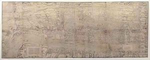
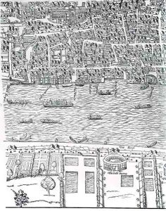
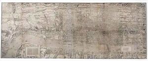
Another significant contribution by Agas is his map of London, known as 'Civitas Londinum', believed to have been created around 1561, although it was not published until later. This map offers an invaluable snapshot of Tudor London before the Great Fire of 1666. It is one of the earliest known detailed maps of the city, pre-dating the more famous map by John Rocque by over a century.
Despite the importance of his work, many aspects of Ralph Agas's life remain shrouded in mystery, including the exact date of his death, which is generally believed to have occurred in 1621. His maps, however, have left a lasting legacy, providing historians, archaeologists, and the general public with a window into the past of some of England's most iconic cities. Agas's contributions to cartography and urban history are still celebrated today, and his maps are studied for both their artistic merit and their historical significance.


