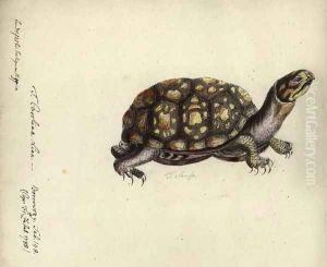
Sotzmann, Daniel Friedrich Paintings
Daniel Friedrich Sotzmann was a German cartographer and engraver who made significant contributions to the field of cartography during the late 18th and early 19th centuries. He was born on August 10, 1754, in the city of Halle, which was then part of the Kingdom of Prussia. Sotzmann's work was influential in the development of geographical knowledge and mapmaking techniques of his time.
Sotzmann was educated in his hometown at the University of Halle, where he likely received training in geography, engraving, and cartography. He went on to work as a cartographer in Berlin, which was a hub for scientific and cultural advancement in Prussia. His career coincided with a period of great interest in exploration and the accurate charting of territories.
Throughout his career, Sotzmann was involved in the creation of maps for various German states, which were then part of the Holy Roman Empire. He is perhaps best known for his work on the 'Atlas von Nordamerika,' which included detailed maps of the United States based on the earliest surveys available during the time. This atlas was commissioned by Christoph Daniel Ebeling, a German professor who was working on a geography and history of North America. Sotzmann's maps were important for providing accurate and comprehensive information about the newly independent United States to a European audience.
Sotzmann's cartographic style was characterized by meticulous detail and a commitment to accuracy. He incorporated the latest information from explorers and surveyors into his maps, which made them valuable resources for navigators, settlers, and government officials. Moreover, his engravings were not only functional but also aesthetically pleasing, featuring artistic flourishes that were typical of the period.
Daniel Friedrich Sotzmann continued to work as a cartographer until his later years, maintaining his reputation as a diligent and skilled mapmaker. He passed away on May 10, 1840, in Berlin, leaving behind a legacy of important cartographic works that would continue to be referenced and studied by historians and geographers. His contributions to the field of cartography were part of the broader Enlightenment movement that sought to understand and document the world through science and reason.
