The 17th century in the Netherlands, often referred to as the Dutch Golden Age, was a period of extraordinary efflorescence in trade, science, military prowess, and the arts. Amsterdam, its vibrant heart, pulsed with innovation and ambition. Within this dynamic milieu, the name Blaeu became synonymous with the pinnacle of cartographic achievement. Joan Blaeu (1596-1673), son of the equally renowned Willem Janszoon Blaeu, not only inherited a prestigious mapmaking enterprise but elevated it to unprecedented heights, leaving an indelible mark on how the world was visualized and understood. His work was not merely functional; it was a testament to the era's artistic sensibilities, scientific curiosity, and global reach.
Early Life and Foundations in a Cartographic Dynasty
Joan Blaeu was born in Alkmaar, North Holland, in 1596, into a family already deeply embedded in the world of knowledge and precision. His father, Willem Janszoon Blaeu (1571-1638), was a figure of considerable intellectual stature. Willem had studied astronomy and instrument making under the legendary Danish astronomer Tycho Brahe on the island of Hven. This rigorous scientific grounding formed the bedrock of the Blaeu family's approach to cartography. Willem established his own business in Amsterdam around 1599, initially producing globes and nautical charts, and later expanding into atlases and books.
Young Joan was thus immersed in an environment where meticulous observation, mathematical calculation, and artistic representation were daily concerns. He received a comprehensive education, befitting the son of a prosperous and learned man. While the family business was undoubtedly a significant influence, Joan initially pursued a different path, studying law at Leiden University. He successfully completed his studies, earning a doctorate in law in 1620. This legal training, though seemingly disparate from cartography, likely honed his analytical skills and attention to detail, qualities that would prove invaluable in his later career.
Despite his legal qualifications, the allure and dynamism of the family's cartographic and publishing house proved irresistible. By the early 1630s, Joan Blaeu was actively involved in his father's burgeoning enterprise. The Blaeu workshop was a hub of activity, employing skilled engravers, colorists, printers, and geographers. It was here that Joan learned the intricate craft of mapmaking, from sourcing geographical data to overseeing the complex processes of engraving copperplates and printing the final maps.
Entering the Family Business and Early Contributions
Joan Blaeu's formal entry into the family business marked a period of continued growth and consolidation for the Blaeu firm. He worked alongside his father and his brother, Cornelius Blaeu (1610-1642). One of their significant early collaborative efforts, though primarily under Willem Blaeu's direction, was the expansion of the Atlantis Appendix into the more ambitious Theatrum Orbis Terrarum, sive Atlas Novus (Theatre of the World, or a New Atlas). The first two volumes of this seminal work were published in 1635.
This atlas was a direct competitor to the established atlas of Jodocus Hondius and Johannes Janssonius. The Blaeus aimed for superior accuracy, aesthetic appeal, and comprehensive coverage. The maps were characterized by their clarity, elegant calligraphy, and often elaborate cartouches – decorative emblems that frequently contained allegorical figures, coats of arms, and dedications. These were not mere embellishments but integral parts of the map's visual and informational narrative, reflecting the artistic tastes of the period.
The Atlas Novus was a monumental undertaking, requiring significant capital investment, access to the latest geographical information, and a highly skilled workforce. Joan Blaeu played an increasingly important role in its production and expansion. His legal background may have been beneficial in navigating the complex world of publishing rights, contracts with engravers and authors, and international distribution.
Assuming Leadership and the Role of VOC Cartographer
The year 1638 was a pivotal one for Joan Blaeu. His father, Willem Janszoon Blaeu, passed away, leaving the flourishing business in the hands of Joan and his brother Cornelius. Joan, as the elder and more experienced son, naturally assumed a leading role. Critically, in the same year, Joan Blaeu was appointed the official cartographer to the Dutch East India Company (Vereenigde Oostindische Compagnie, or VOC). This was a position of immense prestige and strategic importance, previously held by his father.
The VOC was one of the most powerful commercial enterprises in the world, with a vast trading network spanning Asia, Africa, and the Americas. Accurate maps and charts were essential for its navigation, trade, and colonial administration. As the VOC's official cartographer, Joan Blaeu had access to a wealth of up-to-date geographical information sent back by the company's mariners, merchants, and officials from across the globe. This included manuscript charts, rutters (sailing directions), and detailed reports on newly explored territories.
This privileged access to information gave the Blaeu firm a significant competitive advantage. It allowed them to produce maps that were not only beautifully rendered but also among the most accurate and current available. The VOC connection also provided a steady stream of commissions and a guaranteed market for their charts and atlases. However, it also came with responsibilities; much of the information provided by the VOC was considered confidential, intended for company use only, to maintain its commercial and strategic edge over rivals like the English and Portuguese.
After Cornelius's early death in 1642, Joan Blaeu became the sole director of the Blaeu publishing house. Under his astute leadership, the firm reached its zenith, becoming the largest and most renowned cartographic publisher in the world. The Blaeu workshop in the Gravenstraat district of Amsterdam was a marvel of its time, equipped with multiple printing presses and employing a large staff.
The Magnum Opus: Atlas Maior
The crowning achievement of Joan Blaeu's career, and indeed one of the most magnificent cartographic works ever produced, was the Atlas Maior, Sive Cosmographia Blaviana, qua Solum, Salum, Coelum, accuratissime describuntur (Great Atlas, or Blaeu's Cosmography, in which the Earth, Sea, and Heavens are most accurately described). Published progressively between 1662 and 1665, this colossal work typically comprised eleven volumes in its Latin edition, though editions in French, Dutch, Spanish, and German varied slightly in volume count.
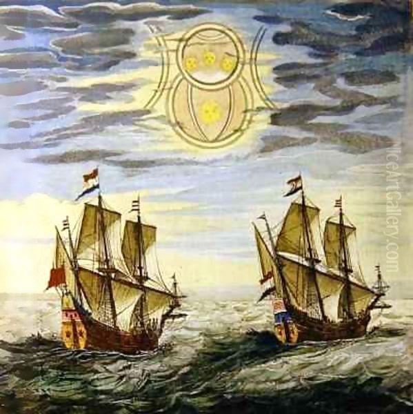
The Atlas Maior contained nearly 600 double-page maps and over 3,000 pages of accompanying text. It was a comprehensive survey of the known world, covering Europe, Africa, Asia, and the Americas. The maps were masterpieces of engraving and design, often lavishly hand-colored by skilled artisans. The decorative elements, including elaborate cartouches, allegorical figures representing continents or virtues, depictions of ships, sea monsters, and indigenous peoples, transformed the maps into rich visual narratives. The calligraphy was exquisite, and the overall aesthetic was one of opulent grandeur.
This was by far the most expensive book published in the 17th century. A complete set, especially a finely colored one, was a luxury item, a symbol of wealth, erudition, and worldly knowledge. It found its way into the libraries of royalty, nobility, wealthy merchants, and learned institutions across Europe. King Charles II of England, for instance, was a notable patron.
The production of the Atlas Maior was a testament to Joan Blaeu's ambition, organizational skills, and commitment to quality. He drew upon the vast archive of copperplates accumulated by his father and himself, constantly updating them with new information. He also commissioned new maps and texts from leading geographers and scholars of the day. The texts accompanying the maps provided detailed geographical, historical, political, and cultural information about the regions depicted, making the atlas a veritable encyclopedia of the 17th-century world.
Other Notable Cartographic Works
While the Atlas Maior stands as his most famous creation, Joan Blaeu produced a wealth of other significant cartographic works. He continued to expand and revise the Theatrum Orbis Terrarum / Atlas Novus throughout his career, with later editions growing to six volumes.
He also ventured into specialized regional atlases. The Blaeu Atlas of Scotland, published in 1654, was a landmark achievement. Based largely on the manuscript maps of Timothy Pont and Robert Gordon, it was the first comprehensive atlas of Scotland, featuring 49 engraved maps. This project involved considerable effort in collating and engraving the source material, and it remains a vital historical resource for Scottish geography.
Another significant undertaking was the Tooneel der Steeden van de Vereenighde Nederlanden (Town Books of the Netherlands), published in two volumes in 1649, and its companion, the Tooneel der Steeden van 's Konings Nederlanden (Town Books of the Spanish Netherlands). These atlases contained detailed plans and views of Dutch and Belgian cities, showcasing their fortifications, prominent buildings, and urban layouts. They are invaluable for understanding 17th-century urban topography.
Blaeu also planned a similar series for Italy, the Theatrum civitatum et admirandorum Italiæ (Theatre of the Cities and Wonders of Italy). While not fully completed to the extent of the Netherlands volumes during his lifetime, parts were published, demonstrating his ambition to create a comprehensive visual record of Europe's major urban centers. His world map, Nova et Accuratissima Totius Terrarum Orbis Tabula, first published around 1648 and revised in later editions (such as the 1662 version mentioned in the provided text), was a highly influential depiction of the globe, often richly decorated with allegorical scenes representing the continents, celestial spheres, and portraits of astronomers like Copernicus and Tycho Brahe. The map of Anglia Regnum (Kingdom of England) was a standard and beautifully executed representation of England and Wales, appearing in his atlases.
The Artistic and Scientific Synthesis in Blaeu's Maps
Joan Blaeu's maps are celebrated not only for their geographical content but also for their exceptional artistic quality. They represent a harmonious fusion of scientific accuracy (to the best of 17th-century knowledge) and aesthetic appeal. The Dutch Golden Age was characterized by a keen appreciation for realism and detailed observation in painting, and this sensibility extended to cartography.
The scientific underpinnings of Blaeu's work were rooted in the traditions established by his father. This included the use of astronomical observations for determining latitude and, where possible, longitude (though accurate longitude determination at sea remained a challenge throughout this period). The firm utilized the best available surveying techniques and mathematical projections. Access to VOC data, as mentioned, was crucial for updating coastlines, particularly in Asia and the East Indies. The depiction of terrain, river systems, and political boundaries aimed for the greatest possible accuracy.
The concept of "chorography," or the detailed description and mapping of regions, was central to Blaeu's atlases. The accompanying texts provided rich contextual information, moving beyond mere cartographic representation to offer a fuller understanding of the lands depicted. This integration of visual and textual information was a hallmark of his comprehensive approach.
Artistically, Blaeu's maps were products of a sophisticated visual culture. The elaborate cartouches were often designed by skilled artists and engraved with remarkable finesse. These were not mere decorations but often conveyed symbolic meaning, celebrating discovery, commerce, or the patrons to whom the maps were dedicated. The use of vibrant hand-coloring, meticulously applied by specialist "afsetters" (colorists), enhanced the visual appeal and legibility of the maps. Gold leaf was sometimes used for highlights, adding to their luxurious quality. The elegant calligraphy used for place names and titles contributed to the overall harmony of the design.
The double-hemisphere world maps, like the Nova et Accuratissima Totius Terrarum Orbis Tabula, often featured allegorical representations of the four continents, the seasons, or the elements in the spandrels (the spaces outside the circular map projections). These elaborate iconographic programs reflected contemporary understanding of the cosmos and humanity's place within it, blending scientific representation with artistic and philosophical commentary.
The Dutch Golden Age: A Flourishing Artistic and Intellectual Context
Joan Blaeu operated within an incredibly fertile cultural landscape. The Dutch Republic in the 17th century was a global economic powerhouse, and this prosperity fueled an unprecedented boom in the arts and sciences. Amsterdam was not just a center of trade but also a hub for painters, scholars, printers, and thinkers.
The demand for art was widespread, extending beyond the aristocracy to the burgeoning merchant class. This period saw the rise of masters whose names resonate to this day. Rembrandt van Rijn (1606–1669) was revolutionizing portraiture and biblical scenes with his dramatic use of light and shadow (chiaroscuro) and profound psychological insight. Johannes Vermeer (1632–1675), based in Delft, created serene and luminous interior scenes, masterfully capturing light and domestic intimacy. Frans Hals (c. 1582/83–1666) of Haarlem was renowned for his lively and spontaneous portraits that seemed to capture the sitter's personality in a fleeting moment.
Genre painting flourished, with artists like Jan Steen (c. 1626–1679) depicting boisterous and often humorous scenes of everyday life, while Pieter de Hooch (1629–1684) specialized in tranquil courtyards and domestic interiors. Landscape painting reached new heights with artists such as Jacob van Ruisdael (c. 1629–1682), whose dramatic and evocative depictions of the Dutch countryside and seascapes were highly sought after, and Aelbert Cuyp (1620–1691), known for his idyllic landscapes bathed in a golden Italianate light.
Still life painting also achieved remarkable sophistication, with artists like Willem Kalf (1619–1693) creating opulent "pronkstilleven" (ostentatious still lifes) featuring luxurious objects, and Rachel Ruysch (1664–1750), who, though slightly later, continued the tradition of exquisite floral still lifes. Other notable painters of the era included Gerard ter Borch (1617–1681), famed for his elegant genre scenes and portraits; Carel Fabritius (1622–1654), a brilliant pupil of Rembrandt whose career was tragically cut short; Ferdinand Bol (1616–1680) and Govert Flinck (1615–1660), both successful portraitists and history painters also associated with Rembrandt; the pioneering female artist Judith Leyster (1609–1660); Adriaen van Ostade (1610–1685), known for his peasant scenes; and Philips Wouwerman (1619–1668), who specialized in equestrian scenes.
This vibrant artistic environment fostered a culture of visual literacy and an appreciation for skilled craftsmanship. The same patrons who commissioned portraits from Rembrandt or bought landscapes from Ruisdael were also the consumers of Blaeu's luxurious atlases. Maps and globes were not only practical tools but also symbols of learning, status, and a cosmopolitan worldview. They adorned the homes of wealthy merchants and the offices of civic institutions, reflecting the Republic's global reach and its citizens' keen interest in the wider world.
Blaeu and His Contemporaries: Interactions and Influence
While Joan Blaeu was primarily a cartographer and publisher, he moved in the same intellectual and commercial circles as many of these prominent artists. Amsterdam was a relatively compact city, and the leading figures in various fields would have been aware of each other's work, if not personally acquainted.
The provided information notes an indirect connection to Rembrandt through Joan's father, Willem Janszoon Blaeu (referred to as Pieter Blaeu in one instance in the source, but Willem is historically accurate as the father and founder). Willem Blaeu was a prominent figure, and it's plausible that artists like Rembrandt would have known him or visited his renowned workshop and shop, which was a center for maps, globes, scientific instruments, and books. The travel diary entry mentioning a visit to "the famous painter Rembrandt" by someone connected to the Blaeu family (likely Willem or an associate) suggests an awareness and respect between these leading figures of Dutch culture.
There is no direct evidence of artistic collaboration between Joan Blaeu and painters like Rembrandt in the sense of Rembrandt illustrating Blaeu's maps. The artistic elements of the maps – the cartouches, allegorical figures, and decorative borders – were typically designed and executed by specialized artists and engravers who worked within the cartographic tradition, such as members of the Visscher family or Romeyn de Hooghe (though de Hooghe was more prominent slightly later).
However, the influence was more likely a shared cultural sensibility. The meticulous detail, the fascination with accurately representing the world (whether a landscape, a portrait, or a coastline), and the pride in Dutch achievement were common threads. Blaeu's maps, with their rich visual appeal, partook of the same artistic spirit that animated Dutch Golden Age painting. They were, in their own way, a form of visual storytelling, conveying not just geographical facts but also a sense of wonder, power, and order.
The Blaeu firm's success also contributed to the overall economic and cultural vitality that supported the arts. The wealth generated by enterprises like the VOC and publishing houses like Blaeu's created the conditions for artistic patronage and a flourishing art market.
Civic Life and Standing in Amsterdam
Joan Blaeu was not only a successful businessman and cartographer but also a respected citizen of Amsterdam. He actively participated in the city's civic life. He served on the Amsterdam municipal council and, in 1651, was elected as a schepen (an alderman or magistrate), a position of considerable local authority. This involvement in city governance indicates his high standing within the community and his commitment to public service.
His role as a prominent publisher and intellectual also brought him into contact with scholars, diplomats, and dignitaries from across Europe. The Blaeu premises were likely a meeting place for those interested in geography, science, and current affairs. The dedication of maps and atlases to influential figures, including royalty and statesmen, further cemented his international reputation and connections.
The Great Fire of 1672 and Its Aftermath
The year 1672 is known in Dutch history as the Rampjaar (Disaster Year). It was a time of grave crisis for the Dutch Republic, which was invaded by a coalition of England, France, and several German states. Amidst this national turmoil, a personal tragedy struck Joan Blaeu and his enterprise.
On February 22, 1672, a devastating fire broke out in the Blaeu printing house on the Gravenstraat. The fire raged through the workshops, destroying much of the premises, including printing presses, type, paper stock, and, most tragically, a significant number of the precious engraved copperplates that were the foundation of their map and atlas production. Many of the plates for the Atlas Maior were lost.
This was a catastrophic blow. The copperplates represented an enormous investment of time, skill, and capital. Their loss meant that reprinting many of their most famous maps would be impossible or prohibitively expensive. The fire is said to have deeply affected Joan Blaeu. The combination of this personal disaster and the national crisis of the Rampjaar likely took a heavy toll on his health.
Final Years, Death, and the Decline of the Blaeu Dynasty
Joan Blaeu did not long survive the fire. He passed away in Amsterdam on December 21, 1673. He was buried in the Westerkerk, the same church where Rembrandt would later be interred.
After Joan Blaeu's death, the family business was continued by his sons, Willem II Blaeu (1635-1701), Pieter Blaeu (1637-1706), and Joan II Blaeu (1650-1712). They made efforts to recover from the fire and continue publishing, even reissuing some atlases. However, the firm never fully regained its former glory. The loss of so many copperplates, combined with changing market conditions and increased competition from other cartographic publishers (like the Visscher family, Frederick de Wit, and later the French school of cartography), led to a gradual decline.
The remaining stock, including copperplates that had survived the fire or were re-engraved, was eventually auctioned off in several sales between 1695 and the early 18th century. Other publishers acquired parts of the Blaeu legacy, incorporating some of their plates into new atlases. Thus, the influence of Blaeu's cartography continued, albeit under different imprints.
Enduring Legacy and Historical Significance
Despite the eventual decline of the family firm, Joan Blaeu's legacy is immense. He presided over the golden age of Dutch cartography, producing some of the most beautiful and influential atlases ever made. His Atlas Maior remains a monument of 17th-century scholarship, artistry, and printing technology.
Blaeu's maps are prized by collectors and institutions worldwide for their historical importance and aesthetic quality. They provide invaluable insights into the geographical knowledge, artistic conventions, and worldview of the Dutch Golden Age. They document a period of intense global exploration and expanding European influence, capturing the world as it was understood by one of its leading maritime and commercial powers.
From an art historical perspective, Blaeu's work exemplifies the close relationship between art and science in the 17th century. His maps were not merely utilitarian objects but sophisticated cultural artifacts that reflected and shaped contemporary perceptions of the world. The decorative elements, the quality of engraving, and the luxurious presentation place them firmly within the broader artistic achievements of the Dutch Golden Age.
Joan Blaeu's commitment to accuracy, combined with his entrepreneurial acumen and artistic sensibility, ensured that the name Blaeu would forever be associated with the highest standards of cartographic excellence. He was a pivotal figure in the history of mapmaking, and his magnificent atlases continue to inspire awe and admiration, serving as a vibrant testament to the intellectual and artistic vitality of his era. His work reminds us that maps are not just tools for navigation, but complex cultural documents that tell stories of power, knowledge, and artistic vision.